Key Stats
- Altitude
- 2,326 m
- Category
- Category 1
- North side
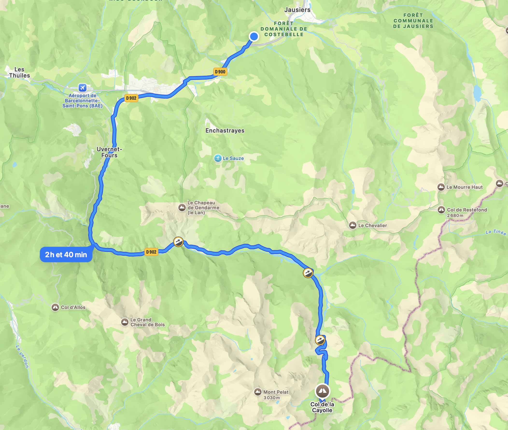
- 35 km from Barcelonnette
- Elevation gain
- 1,191 m
- South side
- Approx. 29 km from Saint-Martin-d'Entraunes
- Open season
- May to November, conditions permitting
- Surface
- Tarmac — fully paved
- Access
- Free — no permit required
Use these numbers as your planning baseline, then check current pass status before committing to the ride. For the wider route network, start with our full cycling guide for the Ubaye Valley.
North Climb (From Barcelonnette)
The official north-side ride starts in Barcelonnette and follows the Ubaye valley before turning toward the high road. Saint-Paul-sur-Ubaye is an intermediate landmark on the approach, useful for pacing and refilling, but Barcelonnette is the reference start point for the full climb.
South Climb
The south side rises from the upper Var valley through a wilder, narrower mountain setting. It is shorter than the Barcelonnette side, but the road still demands steady pacing, attention on the descent, and a realistic weather window.
Difficulty
Col de la Cayolle is a Category 1 climb: long enough to shape a full day, but generally steadier and less extreme than the highest Alpine giants. The challenge comes from distance, changing temperatures, and the remote Mercantour setting rather than savage gradients.
Ride the lower valley at endurance pace, eat early, and keep a light jacket for the descent. The climb rewards riders who stay patient and treat the final kilometres as mountain terrain, not a late sprint.
Weather
The pass usually offers its best riding from June to September, with May and November dependent on snow and cold. Even in warm valley weather, the summit can be windy, shaded, and much cooler.
| Month | Road status | Conditions | Recommendation |
|---|---|---|---|
| May | Often opening | Cool mornings, snowbanks possible near the top | Ride only after checking the latest pass status |
| June | Usually open | Fresh temperatures, bright light, low traffic | Best early-season window for prepared riders |
| July | Open | Warm valleys, cooler summit, long daylight | Reliable month for a full Cayolle loop |
| August | Open | Hot approaches, afternoon storm risk | Start early and carry extra water |
| September | Open | Stable, quieter, crisp air | Best overall month for a calm mountain ride |
| October | Variable | Shorter days, colder descents, frost possible | Choose a clear forecast and bring warm layers |
| November | Closing period | Winter conditions can arrive quickly | Only ride lower sections unless the pass is confirmed open |
Base Camp
Les Gîtes de l'Argile works as a single base for a two-col Ubaye plan: ride Col de la Bonette on one day, then Col de la Cayolle when the weather opens a calmer Mercantour window.
Choose L'Intermède or La Capitale for a quiet stay close to Barcelonnette, with the practical setup cyclists need between mountain days.
- Secure bike storage for road bikes and kit
- Powerful showers after long mountain days
- Fully equipped kitchen for early breakfasts and recovery meals
- Fast WiFi for route checks, weather, and remote work
For a non-cyclist companion, Barcelonnette offers cafes, markets, riverside walks, and relaxed mountain days while you ride.
Book your stayGetting There
Parking : Barcelonnette. From Les Gîtes de l'Argile, roll into Barcelonnette and follow the valley approach toward the Cayolle road. For more routes and accommodation context, see Cycling in the Ubaye Valley.